
When you think about going on a road trip, I bet you don’t think of heading to Tajikistan.
But one of the world’s best road trips is in Tajikistan – on the second highest highway in the world! At its highest point, the Pamir Highway reaches 4,655 metres above sea level.
The Pamir Highway stretches from Dushanbe, Tajikistan to Osh, Kyrgyzstan, passing through the Pamir Mountains. The highway was built by the Soviet military in the 1930s.

You can access the Pamir Highway by hiring a driver or renting your own car (or hitchhiking if you have a lot of time) – but be aware that the pavement is poor (sometimes non-existent) in most areas, and some sections are very bumpy. This part of the world is also very isolated.
Along the way, you’ll drive through two countries, and also have the added bonus of looking into China, Afghanistan and Pakistan. Tick that bucket list!
So what’s it really like to drive the Pamir Highway and should you do it? Read on to find out.
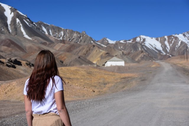
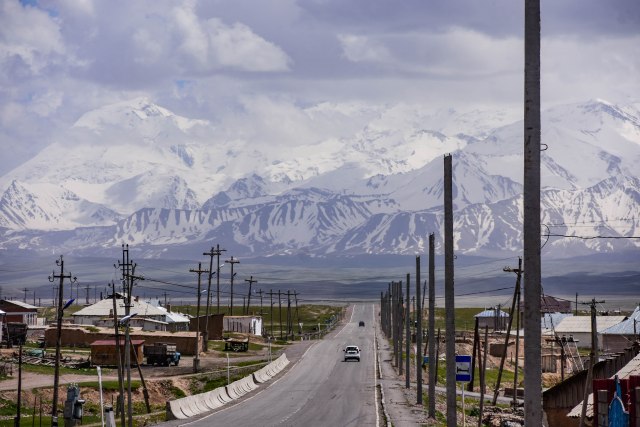 The view from Sary Tash, Kyrgyzstan. This road leads to China.
My Pamir Highway adventure spanned five days and started and ended in Osh. The following days took me through the towns of Murghab, Langar and Khorog. returning to Osh back through Murghab. This is a mini-version of the more traditional 10 day trip that many backpackers do, which stretches to Dushanbe and allows for side trips off the highway.


Day 1
The first day of my Pamir Highway adventure started in Krygyzstan – in the city of Osh with my newest backpacking friend Robbie.
We were picked up from our hostel by our guide Bakir from Pamir Adventure Travel promptly at 9am, and headed to the supermarket for supplies.
Here we grabbed fruit, nuts, water and chocolate bars to fuel our adventures. Main meals are supplied by guesthouses and teahouses on the way.
Once we had all of our supplies and a car full of fuel, it was onwards towards Tajikistan.
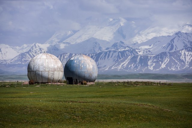 A former Soviet observatory in Kyrgyzstan.
Driving to the Kyrgyzstan-Tajikistan border from Osh took about two hours with a lunch stop at a teahouse located at the crossroads village of Sary Tash. Take the left road and you’ll go to China. The right road leads to Tajikistan. From here, you got an impressive view of the mountains – including 7,134 metre Lenin Peak. Lenin Peak straddles the border between Kyrgyzstan and Tajikistan, and is the second highest point in both countries.
 Officially in Tajikistan!
After passing an old Soviet observatory and two girls on a donkey, we reached the Kyrgyzstan border crossing and passed easily through. Then it was a 20km stretch of No Man’s Land to the Tajikistan Border Control via the 4,280m Kyzylart Pass. Once past the border control, we were officially in Tajikistan – country #86 for me!
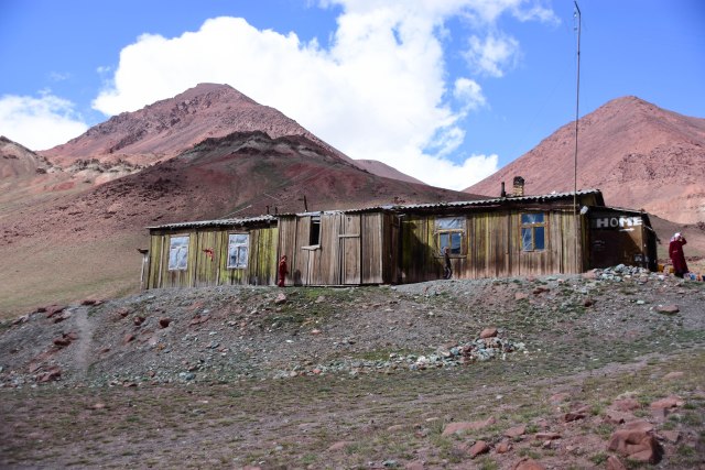 The only house in the so called No Man’s Land.
The road was rocky and bumpy from here towards tonight’s guesthouse at Murghab – the hometown of my guide and driver.
On the way, we looked across to the mountains of China, with only a fence separating Kyrgyzstan and China.
Murghab is a dusty town located at 3,300 metres above sea level. It was coloured grey and brown from the dirt and I don’t think I saw even a glimmer of green. Given the altitude, it was a cold night but we were given plenty of blankets.
The guesthouse had two single beds, a long dining area, an outside Western toilet, and a Russian sauna where we showered using a bucket.
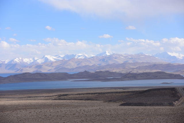 Kara Lake near the Kyrgyzstan border.
Day 2
The second day of the road trip took us to the Tajikistan-Afghanistan border!
In my opinion, Day 2 was the most spectacular section of the road trip as we headed towards the village of Langar.
The drive once again featured dusty, rocky roads which blew one of the 4WD’s tyres early on in the day. After the roadside tyre change, we headed off road to get some beautiful views of lakes and see a geyser, and then we had lunch by a river.
There was also a beautiful, slightly scary, narrow, winding drive on the highway heading up and along plateaus as we drove through the Wakhan Valley. A few times there was only a few centimetres between the car’s tyres and a yawning drop below.
After some tense moments, we reached a river which acts as the border between Kyrgyzstan and Afghanistan.
I stood so close to the border that you could throw a rock into Afghanistan. At one point, you were standing in Tajikistan and could see peaks in both Afghanistan and neighbouring Pakistan.
 One photo, three countries. The road is in Tajikistan. To the left is Afghanistan, and the peaks in the far background are in Pakistan.
Along the way, we stopped in at a local house and were served up a bowl of freshly made ayran made from yak’s milk. It was the most delicious ayran I’ve ever tasted.
On the approach into Langar, we stopped at the ruins of a fort – and were followed by two curious local girls who had the most captivating beautiful eyes. They could speak a little English, asking our names, ages, and if my friend and I had husbands.


After our walk to the fort, the girls followed us back to the car and we gave them balloons and some chocolate bars.
The second day of the Pamir Highway road trip ended with a sit-down dinner of yak meat soup, bread, sweet biscuits and tea inside a traditional Pamir house – and we joined a group of American and Korean travellers who were also traversing Tajikistan.
This guesthouse had us sleeping on mattresses on the floor, and the luxury of an indoor shower (hot water was hard to get though) and toilet.
Day 3
It was a slow start to the day as Robbie had suffered a bout of food poisoning throughout the night. But she soldiered on, crawled into the car and we were off.
We were meant to start by seeing some petroglyphs but because Robbie was sick, we decided to skip it and started the day’s adventures with a visit to a hot spring in a cave . The water was deliciously warm.
After the hot spring, there was a couple more forts to look at, a museum to learn about Tajik history and traditions, and we stopped for plov (local rice dish) and tea at a small restaurant.
There was another stop at a hot spring but it was boiling and I could barely get in up to my knees. The baths are gender segregated in Tajikistan – and the etiquette is to go in without a swimsuit.
Most of the drive had us driving along the Afghanistan border. We ended up driving about 600km following the northern Afghanistan border.
 Tajik mineral hot spring. The water was boiling!
After the second hot spring, we headed to Khorog – driving via a beautiful canyon which looked magical in the light of the setting sun.
Tonight’s guesthouse was the most modern on the trip with a glorious shower inside a sauna – and even (some) wifi.
 En route to Khorog.
Day 4
The fourth day of the trip had us heading back to Murghab. There wasn’t much to see on this stretch – although there were some highlights when we passed rivers and hot springs. Sadly, all the hot springs were closed that day so it was a long day in the car.
Day 5
This was the last day of the road trip and had us heading back into Kyrgyzstan.
It was also one of my favourite days. We needed to get back to Osh by 3pm for a flight back to Bishkek, so we started off early. We were joined in the car by a family – a mum and her three kids.
It was one of the most beautiful mornings on the trip with brilliant clear blue skies, making for a perfect backdrop against the snow capped mountains.
Along the way we stopped at the beautiful azure lake of Karakul, saw Lenin Peak again and took obligatory selfies at the highest point of the Pamir Highway, which is conveniently noted with a sign. The Ak Baital Pass rises to 4,655m at it’s highest point.

 Posing at the highest point on the Pamir Highway – 4,655 metres above sea level!
We crossed back over the border, and I got some curious questions about my marital status and how often I eat kangaroo.
Then it was back into No Man’s Land, and once back through the border, we returned to Kyrgyzstan.
Why you should go
Tajikistan features incredible scenery at every turn and the road trip is one adventure you’ll never forget. You’ll see mountains, sunsets, hot springs, fort ruins, lakes and even petroglyphs! You’ll also learn about the country’s fascinating history and culture and taste traditional food. All the ayran!
I highly recommend hiring an English speaking driver for several reasons. It takes the stress out of traversing the rocky roads if you were in your own car where it’s all too easy to blow a tyre – and you also can ask as many questions as you like about Tajikistan’s history, food, people, culture and landscapes and be guided by somewhere very familiar with the area and its customs. It was a fascinating road trip and one I’ll never forget.


Things you should know
- Travelling independently in Tajikistan can be difficult unless you have a bicycle or motorbike. Your best option is to hire a driver or hire a car but be aware that this is a very remote part of the world and you should carry extra tyres, water, fuel and food if going it alone. Hiring a driver is the preferred option for many travellers to traverse the Pamir Highway given the difficulties. If you have a lot of time, you can try your luck on public transport or hitchhiking but I couldn’t recommend it. Many areas we didn’t see another car for hours.
- The most common route to traverse the Pamir Highway is from Osh (Kyrgyzstan) to Dushanbe (Tajikistan). This can be done in either direction and most people take about 10 days to allow for side trips. But it’s also possible to do a five-day version like I did that starts and ends in Osh and stops at the towns of Murghab, Langar and Khorog.
- You might want to bring your own toilet paper. Toilet paper in this part of the world can be like sandpaper.
- Some guesthouses will only have squat toilets and they will likely be located outside with a hand basin.
- Be prepared to eat lots of yak meat and plov (a traditional rice and vegetable dish cooked in animal fat).
- You need a visa to enter Tajikistan, and a permit to enter the Gaborno- Badakhshan Autonomous Region (GBAO), which covers much of the Pamir Highway. Both can be obtained online. The Tajikistan visa costs $50 USD and the permit costs $20 USD. You need both to do the Pamir Highway road trip.
- Along the way, you will need to show your passport and permit at military checkpoints – so keep them handy.
- Much of the Pamir Highway is 3,000 metres above sea level. If you’re prone to altitude sickness, consider bringing some altitude sickness tablets with you. Make sure you also drink plenty of water.
- Motion sickness is also a threat due to the poor state of the roads.
Loved reading your 5 day Pamir Highway experience in Tajikistan. It reignited wonderful memories of our visit to the 5 Stans 4 years ago. We trekked beautiful valleys and mountains in Kyrgyzstan and Tajikistan without being hindered by hordes of other tourists. I’ll never forget the beauty of Iskander Kul Lake in Tajikistan on a lovely sunny day, truly memorable !
Thanks for reading Bruce! There still isn’t that many tourists there now but I think the Stans are gaining in popularity! The last day I’m Tajikistan was my favourite weather wise, the blue skies were incredible.
This was such an interesting read and has really peaked my interest in travelling the Pamir Highway! Could you give me details on the driver/company you went with, the cost and so on? Was it difficult to find fellow travellers to go with you to lessen the cost? Thanks in advance!