
If you love hiking, then you MUST visit Georgia.
Ok truth be told if you like wine, cheese and history – Georgia is also a must see. But if you love mountains, valleys and meadows, mixed in with ruins and cows, then Georgia should be your next hiking adventure.
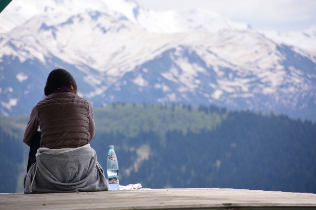
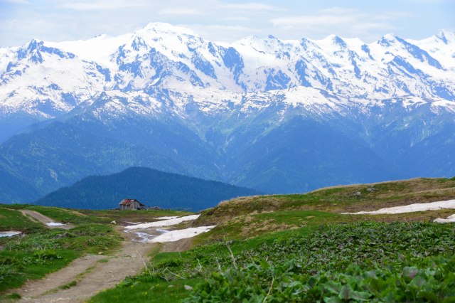
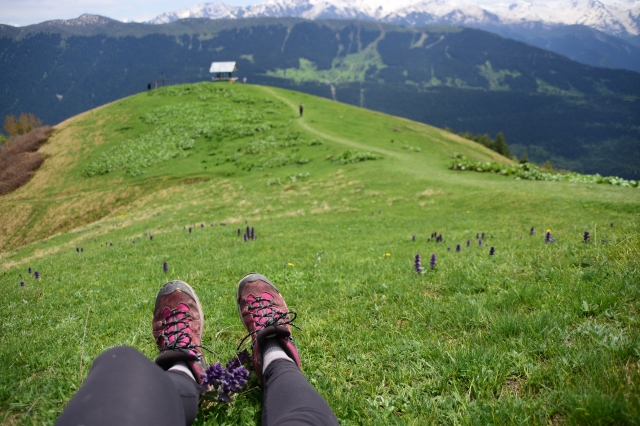
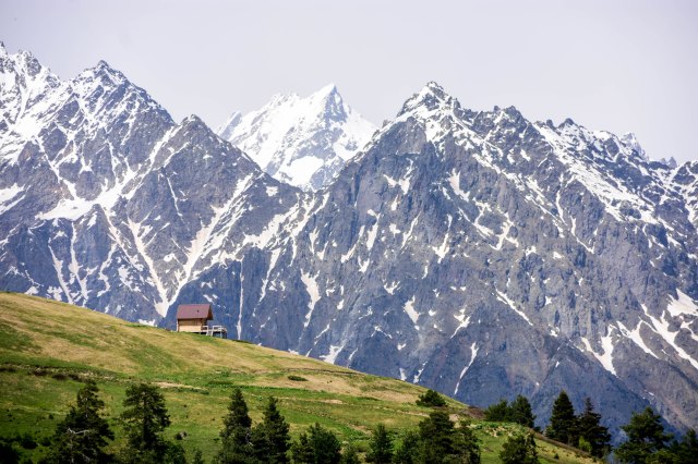
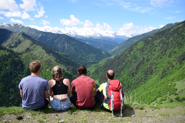
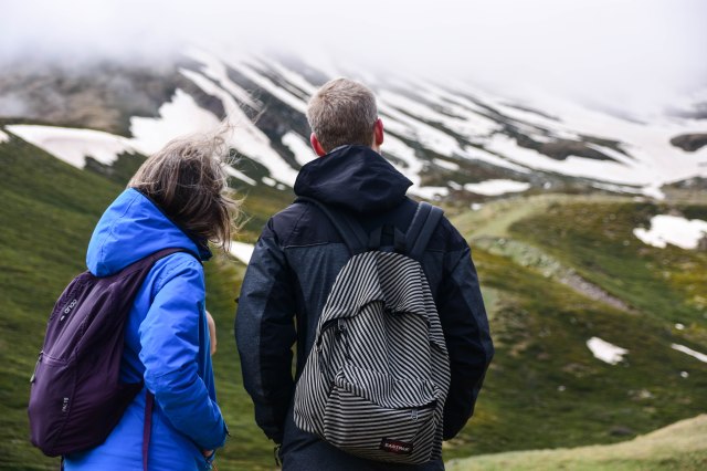
Check out my list of the best hiking destinations in Georgia. I guarantee the photos alone will have you looking at flights to Tbilisi.

When to go?
The best time of year for hikers to go to Georgia is June to September, with July and August being the peak months when snow has melted in the high mountains.
Be aware that while the summer months are the best time to visit, the weather is humid and you may experience thunderstorms mid-afternoon – especially in June. But it does mean all the valleys will be nice and green.

Where to hike?
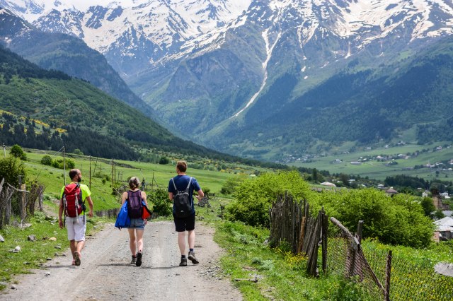
Mestia
Mestia is the most well-known of Georgia’s hiking hotspots. To get to Mestia, you can take an overnight train from Georgia’s capital Tbilisi to Zugdidi and then a marshrutka to Mestia, or take the marshrutka all the way to Mestia. The train departs at 9.45pm daily and arrives between 6am and 8am in Zugdidi. Marshrutkas meet the train. The direct marshrutka from Tbilisi to Mestia takes about nine hours (including breaks).
On the approach to Mestia, you’ll soon spot the beautiful Caucasus Mountains that attracts locals and tourists alike for hiking and skiing.
The most popular hikes are to the Chalaadi Glacier, Koruldi Lakes and the 4-day trek from Mestia to Ushguli. Chat to the friendly staff at the Tourist Information Centre in Mestia to find out your trekking options and snow conditions.
The trek to the base of the Chalaadi Glacier takes about two hours return. You used to be able to walk to the trailhead from Mestia but due to roadworks, this is not as scenic as it used to be. It’s recommended to bargain for a taxi from the centre of town. If your time is limited in Mestia, I recommend skipping this hike.
But you must do the spectacular hike to Koruldi Lakes. You start from the centre of town (follow the signs) – and it’s a steep, steady push up the mountain. You get great views of the surrounding snow-capped mountains along the entire hike, especially at a viewing platform about halfway up.
From the platform, it takes about 90 minutes to reach the beautiful lakes.
The hike will take about three hours each way.
Mestia to Ushguli
About half of the people coming to Mestia plan to do the four-day hike to Ushguli – one of the highest continuously inhabited locations in the world.
The hike involves some massive climbs in elevation, the potential to hike through snow on the mountain passes, and passing through some truly spectacular scenery. You stay at guesthouses along the way in the towns of Chvabiani or Zhabeshi on the first night, Adishi on the second night and Iprali on the third night.
Due to time constraints, I didn’t end up doing the 4-day trek to Ushguli, but opted instead for a variation which extended over two days and covered a whopping 50km!
The first day of the hike followed the same route as the first day of the trek to Ushguli, and ended in Chvabiani at Maia’s Guesthouse. The first day follows a gravel road and narrow path most of the way.
On the second day, my hiking buddies and I headed towards the village of Tsvirmi. Leaving Chvabiani, you head away from the river and up a switchback bitumen road.
Eventually, you leave the bitumen road and head onto a gravel track towards Tsvirmi. You pass through Tsvirmi, and then head uphill again, staying above the valley as you walk towards the village of Ieli. After heading down into Ieli and passing through the village, you end up on a dirt road and take this back towards Mestia. Eventually, you’ll end up on the bitumen road that links Mestia to Ushguli and you can follow this all the way back to Mestia.
For the time poor, this is a spectacular route. The route isn’t marked, but you hike on the road and well trodden paths for the entire route. All you need is the Maps.me app and a charged up phone to ensure you’re following the track as you can see the trails all across Georgia on this app.
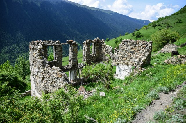
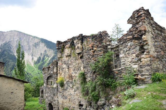
Along the way, you get great views of the mountains, cross creeks, follow part of a river, see daily life in rural villages, and get close to lots of Svaneti fortified towers – and cows. The famous Svaneti towers date back to the 12th century, and were once used by villagers to protect themselves against invaders.
Kazbegi
If you’re craving more mountains after Mestia, then head to Kazbegi, located on the east side of Georgia.
Getting to Kazbegi from Tbilisi is easy and takes about three hours. If you’re travelling solo, you can catch a marshrutka for 15 GEL ($5 USD) or if you’re in a group of three or more, you may be also able to negotiate a more comfortable ride in a taxi also for around 25 GEL ($9 USD) per person.
The journey to this mountain region is just as beautiful as the town of Kazbegi, as you drive past mountains, including through the ski town of Gudauri and along the Georgian Military Highway. If you’re in a shared taxi, you can negotiate with the driver to stop at the Friendship Monument, Ananuri Monastery and various viewpoints on the way up to Kazbegi.
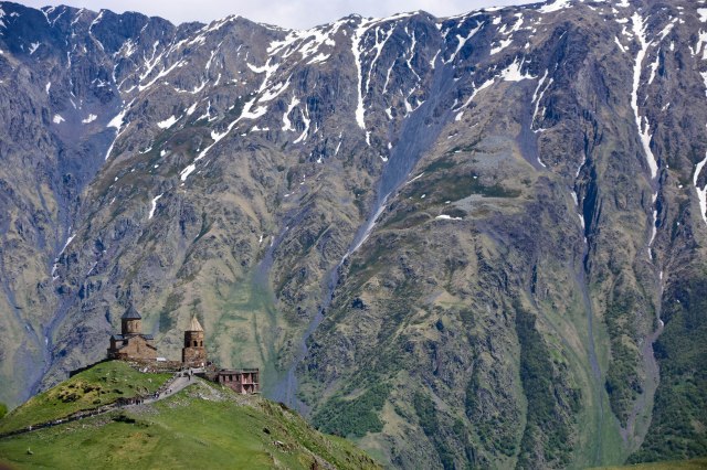
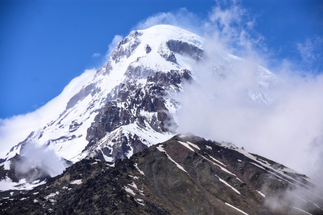
During your stay in Kazbegi (also known by its Georgian name of Stepantsminda), you can enjoy views of 5,047m Mt Kazbek, the Gergeti Trinity Church and head up to the base of the Gergeti Glacier.
You can start the hike to the Gergeti Glacier from the centre of Kazbegi and it takes about 8 hours return. This hike is only recommended for experienced hikers as it’s long and steep with some slippery and rocky sections.
It’s a steady uphill slog to the base of the glacier via the 14th century Gergeti Trinity Church. Once again, it’s good to have the Maps.me app to guide you along this route.
To get to the church, head up through the upper reaches of town towards the church. There are some signs along the way. You’ll head towards a ruined tower and head up a gully to the right of a creek. Follow the rough footpad up and it will bring you out on the left side of the church. You can also choose to walk up the car road the whole way. This section will take about an hour.
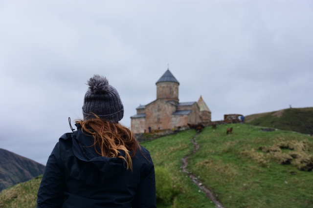
Take a break at the church and have a look inside. Women need to wear a skirt to go inside but you can borrow one at the entrance. Entrance is free.
From the church, head straight ahead and follow the footpad along, steadily gaining altitude. Don’t forget to check out the view of the church with its jawdropping backdrop of mountains as you climb.
Be prepared for trekking across snow, experiencing very cold and windy temperatures, and getting caught in hailstorms and white outs from low clouds and fog during the hike to the Gergeti Glacier. Essentially, be prepared for every type of weather – so that means bring warm and wet weather gear.
It’s a slow steady hike up towards Gergeti Glacier. First you’ll go up a small hill and then have a choice of routes.
The left route is slightly shorter, but the right is more scenic. I ended up taking the left path up and the right path on my descent.
About two hours after you left the church, you’ll reach Sabertse Pass and get a great view of Mt Kazbek. From here, it’s downhill towards Altihut (mountain hut). You’ll cross a river just before you reach Altihut then head up to the glacier.

You can also get a great view of Kazbegi, Mt Kazbek and over the Juta Valley from the church up the hill behind the Rooms Hotel. To get there, head towards the Rooms Hotel and follow the road up the hill to the right. It’s not really a hike – but it does have a great view – and can even be done in winter.


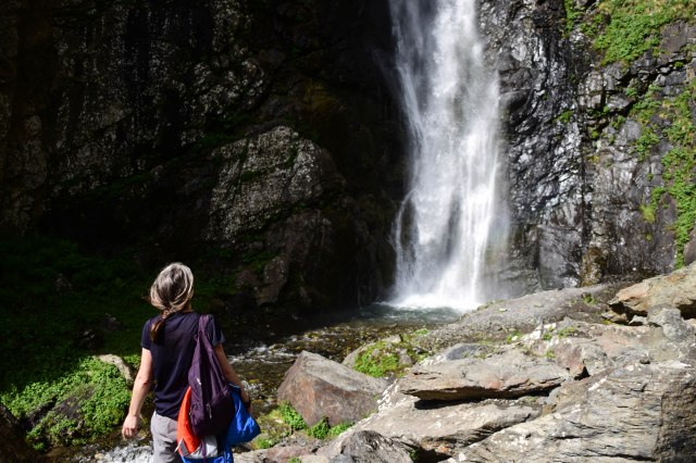
Another hike near Kazbegi is to the Gveleti Waterfall. You can take a taxi from the town centre or hitchhike to the trailhead. The road that leads to the waterfall is marked, or you can also see it on the Maps.me app. From where the taxis drop you off, it’s only a one hour round trip to the big Gveleti Waterfall (there’s also a small one, but better off just going to the main event.)
Truso & Juta valleys
It’s also worth seeing the Truso and Juta valleys, which are located south of Kazbegi.
To get to these areas from Kazbegi, you can take a tour, hail a taxi or hitchhike.
A taxi works well if you are a group of three or more people. You can expect to pay anywhere between 100-150 GEL ($35-$50 USD) for the return trip for the whole car. Make sure you agree on the return price and duration of your hike (at least six hours).
If you’re a solo traveller or a group of two, the best option to organise a transfer with Mountain Freaks, a tour company based in the centre of town.

To get to Juta or Truso valleys, Mountain Freaks charges 45 GEL per person to be dropped off at either trailhead and picked up after six hours. You’ll depart Kazbegi at 9.15am and be picked up at 4.30pm.

The six-hour return hike into the Juta Valley is well marked and easy to follow. Continue walking past the main spa resort you get dropped off at, and climb straight up the steep hill next to you. About 20 sweaty minutes later you will reach the top of the hill leading into the Juta Valley.

This hike is set out in a large L shape, hooking to the left towards the end of the first valley. It takes about an hour of heading very gradually up, and one or two river crossings to come to a turn, then another two hours and countless false peaks later you will arrive at the highlight of the hike – the three lakes.
This hike follows a glacier-fed river with drinkable water, however there’s no shade on this route.

If you are running ahead of schedule for the pick up time and it’s a sunny day, you can chill out on the hammocks and enjoy a hot or cold drink at the Fifth Season bar and accommodation on your way back. Fifth Season is located about a 20 minute walk from the start of the trailhead.
The Truso Valley is often described as the most beautiful valley in Georgia. The walk through Truso Valley is a unique experience as you wind past bright green rolling mountains, abandoned villages or villages with only a few inhabitants, mineral springs, travertine formations and end at a fortress.

Truso Valley is accessed from the village of Kvemro Okrokana. The route is extremely easy to follow. Cross a small bridge over the Terek River near the village, turn left, and follow the dirt road for three hours, occasionally moving to the side for any tour buses driving through. This is not a strenuous hike, but there’s no shade, so bring water, a hat and a packed lunch.

The hike ends at the ruins of the Zakagori Fortress on the border of the disputed region of South Ossetia. Make sure at least one person in your group also brings their passport or the border patrol at the fort may not let you visit to take photos. You’re not allowed to take photos in the direction of South Ossetia.

Racha
Information and photos provided by Andrew Moffatt from @regulartravel
Racha is another beautiful mountain region of Georgia – but you won’t find many tourists venturing here.
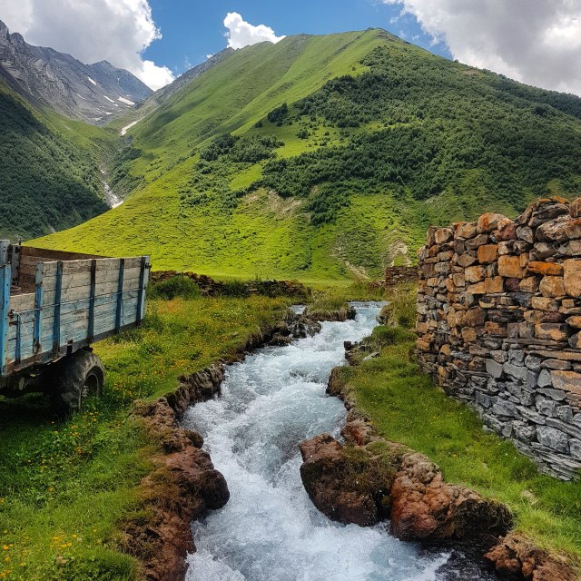
The region is situated in northern Georgia near the Russian border. It has similarities to the Mestia region, with fabulous hiking to be had among towering snowcapped peaks, however it’s more undiscovered and wild and you are likely to have the trails all to yourself.

Getting there and away
The main towns of the Racha region are Ambrolauri and Oni. Marshrutkas leave for Oni via Ambrolauri from Tbilisi’s Didube station at 8:30am. As of May 2019, there were three services running at 8am, 8:30am and 9am. The cost is 25 GEL ($9 USD), and takes about seven hours, including one rest stop. Don’t forget to look out for the view of the beautiful Lake Shaori during the drive.
There’s only one service a day from Kutaisi to Ambrolauri departing at 4pm.
You will first reach Ambrolauri, denoted by the giant bottle of kvanchkhara wine, which is proudly produced in the region.

Grab some wine while you’re here, and don’t forget to try the local lobiani (Georgian bread stuffed with beans). Highly recommended is the lobiani with ham from the bakery across the road from the bus station.
The town of Oni is about a 30 minute drive further on. It’s a cute and sleepy town, with a few viewpoints scattered around the town to keep you entertained for a few hours, but largely serves as a hub to get out to the more remote villages so you can do some hiking.

Past Oni, there is very little in the way of public transport. There’s a market bus that runs once a week to the village of Ghebi. Locals said it left around 5pm on Thursdays from Oni. But for the rest of the week, it’s either hitchhike, and there are the occasional cars going that way, or take a taxi at a cost of 60 GEL ($20 USD) one way.
Once you’ve had your hiking fix around Ghebi, you can return to Oni again via hitchhiking or taxi. There is a marshrutka at 2.30pm from Oni to Ambrolauri, and from there it’s possible to get to Kutaisi or Tbilisi almost every 30-60 minutes throughout the day.

Day hikes in the Racha region
The wait to get to Ghebi will all be worth it once you see the beauty of this secluded village nestled among a T-shaped valley of snowcapped peaks. There’s some multi-day trekking options from Ghebi, but for those without any camping gear, there’s also a couple of day hikes you can do.
The hike from Ghebi to Gona starts by walking from the town back towards Oni for about 15 minutes. You’ll then see a military road hooking backwards and then uphill. Follow this track through a treelined and sporadically shaded road, crossing the occasional shallow stream or river via bridges, and this will take you towards the village of Gona.
You’ll arrive in Gona after about 2-3 hours, and then can continue on towards the glaciers if allowed at the military checkpoints. As these mountain ranges are on the border with Russia, you will need to have your passport on you as you may be stopped by military personnel. There’s a chance you may not be able to proceed past Gona to the glaciers beyond, so simply enjoy the views here with a picnic lunch and then go back the way you came.

The hike from Ghebi to Brili starts by following the Rioni River to the west. You’ll find a well marked trail that is part of the Trans-Caucasian Trail.
If you have camping gear, you can start on this trail for the three day trek to Zeshko, but know that the second day of this trek involves a particularly brutal climb on an unmarked trail through waist-high hogweed, so should only be attempted by experienced hikers.
Day hikers however will enjoy the first day of this hike, which takes you to Brili. The hike traverses small remote villages home to no more than a dozen people; you will follow the picturesque Rioni River; find farmers leading cattle eager to chat to foreigners coming through their land and set your eyes on sweeping panoramas of uninterrupted mountains.

If you come through not long after the winter season, you may also encounter flooded access roads, making crossings slow at points, and might find yourself walking barefoot through shin-high rivers.
Eventually, you will arrive at a fork in the river, with the Zhokhituri River joining the Rioni River to your right; fed by the same glacial alps you will see on the hike to Gona.

On your left will be a beautiful open meadow perfect for some idyllic camping if you are continuing onto Zeshko. Otherwise, stop here to enjoy the views then return the way you came.
Accommodation and food
Ghebi is home to only 400 people during the summer months, and they are among the most hospitable, proud and kind-hearted Georgians you’ll meet.
There are several guesthouses in this town, however the cost of accommodation is high by Georgian standards, owing to the remote location and the difficulty to get supplies in. Expect to pay about 60 GEL ($20 USD) per person per night for accommodation and two meals, which is similar to prices for guesthouses located along the more popular Mestia-Ushguli trek.
There is one very simple store in town, where you can pick up bare basics (including much needed post-hike beer and wine!) but it’s recommended to plan ahead and bring up most of your hiking snacks and anything else you might need for a few days in the mountains from Tbilisi and Kutaisi.
Things you should know
- Many of the hiking trails in Georgia lead from the centre of the main mountain towns.
- You can get around Georgia with a combination of marshrutkas, trains, taxis and hitchhiking.
- The weather can change quickly in the mountains. Make sure you always take a rainjacket, dry bag or backpack rain cover, and warm clothing on your hike in addition to snacks, water, a hat and sunscreen.
- If you’re doing a multi-day hike in Georgia, it’s not always essential to bring a tent as most routes are serviced by guesthouses. The exception is in the Racha region.
- Ask the Tourist Information Centres in Kazbegi and Mestia for up to date information on trail conditions.
- Be careful with water sources in Georgia as there are many farm animals roaming the mountain areas that may pollute rivers. You might want to consider bringing a water treatment system with you on your trek in case you can’t find a water spring.
Hi Lisa, fantastic article! A friend and I are planning to hike from Mestia in the first week of May – I appreciate this is not the ideal time as snow may still be on the ground in most places. I wondered from your own experience whether there are still good multi-day hikes to be had this early in May, or if it’s really a no-hoper for Mestia this time of year?
Many thanks! Em
Hi Emily, thanks for your comment. It depends on the winter – so it’s hard to say. I’ve visited Mestia in late May and early October and there was snow but not much, it might be possible to at least do the day hikes, not sure about multi day. Might be worth contacting the Transcaucasian Trail people on their Instagram page, they will have some better advice around conditions as the admin team live in Georgia.