
Canberra is left off most traveller’s itineraries for the bright lights of Sydney and Melbourne and the marine life of the Great Barrier Reef.
But if you’re a hiking enthusiast and want a real taste of Australia’s great outdoors, then you might want to spend a few days taking a look around the Canberra region– but you’ll need a car.
The Canberra region is blessed with some excellent national parks and nature reserves with well-maintained and scenic trails. Check out my list of the best hikes in and around Canberra and you’re sure to find the trail for you.
Mt Ainslie, Canberra
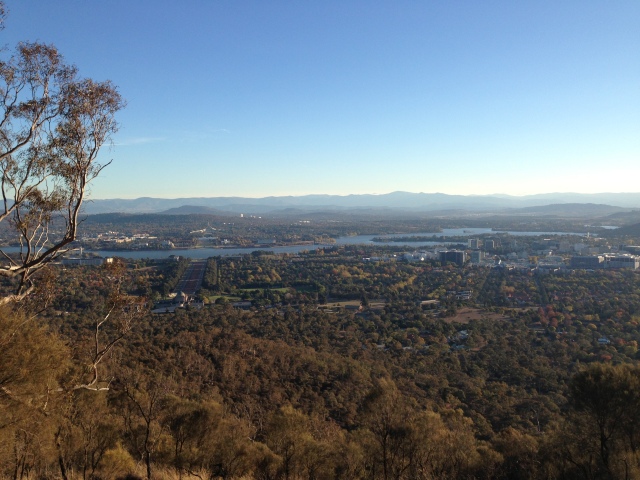
Mt Ainslie is a local favourite due to its handy location adjacent to the city centre. You can even walk here from the centre, known locally as Civic.
Getting up Mt Ainslie can be done in about 30 minutes depending on your fitness level. It’s a sealed path up to the lookout. The lookout has panoramic views of Canberra and it’s a great one for visitors to clearly see many of the city’s key landmarks.
Mt Tennent, Namadgi National Park
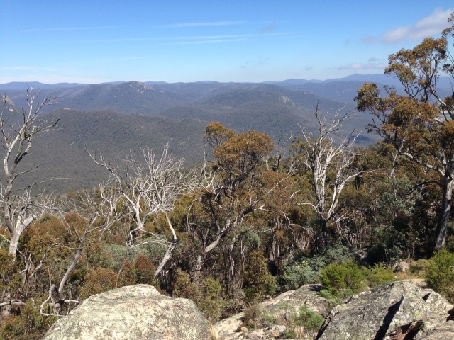
The trailhead up to Mt Tennent can be reached in a little under an hour from Canberra’s centre.
This mountain has an elevation of 1375 metres, and is a 15km return hike. The trail gradually inclines at the start and gets a bit harder after the first lookout point. On a clear day, the views are spectacular even from that first point.
The hike gets a lot harder towards the end with a few steep sections, but anyone of moderate fitness will be able to make it. This track is very well maintained and there are places to stop along the way.
The views at the top – which also hosts a bushfire spotting platform – are outstanding. But make sure you bring a jumper of some sort as it can get pretty windy and cold up there.
This walk took a group of eight people about 4.5 hours return. I almost think the downhill part was more difficult than the uphill as it was pretty hard on the knees and my calves were sore for a good two days after.
If you’re going to attempt Mt Tennent, start early in the day, take a litre or two of water, some snacks and sign in and out of the bushwalking register.
Gibraltar Peak & Camel’s Hump, Tidbinbilla Nature Reserve
 The Tidbinbilla Nature Reserve features some of my favourite hikes in Canberra.
Gibraltar Peak can be reached via an 8km hike or a longer 15km loop that takes you past the reserve’s visitor centre. I’ve done the 8km trail a couple of times starting from the Dalsetta carpark in the Tidbinbilla Nature Reserve. The walk is described as moderate to hard by the reserve signage, but I found it to be more on the moderate side.
It’s a fairly easy walk first through grasslands and then up a gradual incline for about three kilometres, with lots of kangaroo spotting opportunities along the way.
There’s also some interesting rock formations on the way up and near the summit, and a great view across the reserve and over to Black Mountain. The return hike will take 2-3 hours.


The Camel’s Hump hike will get your heart pumping but it’s all worth it at the end when you sit up on top of the Camel’s Hump section and can see for miles on a sunny day.

You can access Camel’s Hump from various points in the park depending on how far you want to walk. I chose to do the 11.6km return hike which starts from the Mountain Creek car park right at the end of the road. This hike will take you around three to four hours return.
The first kilometre or so will get your heart pumping and your calves burning. It’s a fairly steep ascent first up but after about a kilometre or so it starts to level out a bit. Once you start thinking, this is an easy walk then begins the next ascent and you remain going up for about three kilometres or so but it’s not quite as steep as the first section.
This isn’t a very popular walk (but it should be) so you’ll see plenty of wildlife along the tracks – especially pademelons.
The trail offers great views over the reserve and across to Gibraltar Peak as you ascend. You know you’ve nearly made it when you’re greeted with the Camel Back sign. Then there’s a steep, narrow trail up to take in the views but it will only take a couple of minutes to get up.
It was just me, the birds and pademelons at the summit as I sat in the sun enjoying the views.

Tidbinbilla Nature Reserve charges a day use fee per vehicle to enter the park or you can buy an annual pass and enter as many times as you like.
Square Rock & Booroomba Rocks, Namadgi National Park

The Square Rock and Booroomba Rocks trails are both located in the Namadgi National Park – but in different parts of the park. The terrain and views are pretty similar for both of these so if you can only do one trail, Booroomba Rocks is the better choice.
The Square Rock trail starts off Corin Road. It will take about 45 minutes to drive out here from Canberra’s centre.
This is a moderate 9km return hike. It’s not too steep, and the views are pretty nice up the top over the national park. There’s lots of boulders up the top to climb onto and admire the views.

Booroomba Rocks is a short but steep 30 minute walk up. The trail starts off Apollo Road, about an hour from Canberra’s centre. It’s another summit scattered with boulders of all sizes so you can get your rock scrambling on. It’s a good spot to take a picnic up on a sunny day and really admire the panoramic views.
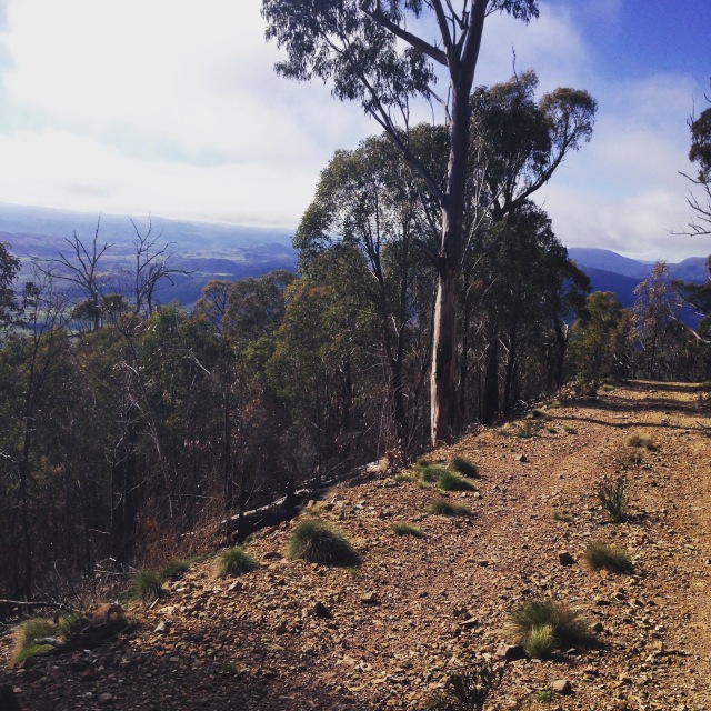
Granite Tors, Namadgi National Park

The Granite Tors walk starts at the site of the former Orroral Tracking Station in the Namadgi National Park.
The 7km return walk is graded as challenging and some parts are steep, but it only takes about an hour to the top. On reaching the end of the hike, you’re greeted with spectacular views of the national park, as well as the Orroral Geodetic Observatory. This is the only building to remain from the old tracking station, and was decommissioned in 1997 when operations moved to Mt Stromlo. The observatory once housed a 10 ton telescope and laser brought from Arizona in the US.

There’s a lookout at the top or there’s plenty of places to sit down, have a picnic and admire the view.
Red Rock Gorge, Kambah

This is an easy trail and is suitable for all fitness levels – but do watch out for snakes on the track in the summer months.
The Red Rock Gorge trail starts from the Kambah Pool carpark off Kambah Pool Road. It’s only about a 15-20 minute drive from Canberra’s centre.
The trail takes you to Pine Island, which is 9km one way. But you can opt to just head to Red Rock Gorge on the Murrumbidgee River, which is only 2km one way and is the best part of the trail.
Molonglo Gorge, Kowen Forest

This hike is located about a 15 minute drive from Canberra’s centre, located between the airport and Queanbeyan off Sutton Road.
Molonglo Gorge is part of the Kowen Forest reserve and I found it pretty cool there was such a beautiful part of the region hidden just behind the airport.
The trail is fairly easy. There are some uphill bits but they’re not that steep or long. The trail follows the Molonglo River and ends up at the Blue Tiles Picnic Area. It’s a 6km return hike and will take you less than two hours to complete.