
With its snow-capped peaks, sparkling turquoise lakes, picturesque forests and glacier carved valleys, Switzerland is a dream to visit for any type of traveller, but particularly for hikers and landscape lovers.

Switzerland has an excellent network of hiking trails, and a world-class transport system to get you there.
But Switzerland is expensive, so to maximise your time there – I’ve picked out some of my favourite hiking trails and villages to make sure you see some of the best views this country has to offer.

Money saving tips
There’s no denying the fact that Switzerland is expensive, but there’s a couple of ways to save some money.
My best tip is to get the Swiss Half Fare Card as soon as you arrive. It costs €120 for the card, but you’ll save this in only one or two days. The card gives you a 50 per cent discount on all buses, trains, cable cars, funiculars and gondolas in Switzerland. Once you have the card, all you need to do is present it every time you buy a ticket and you’ll get it for half price. The Swiss Half Fare Card is valid for one month from date of purchase.
You can also buy a rail pass, which gives you a certain amount of days of rail travel. But because I was mostly travelling short distances on my trip and using Zermatt and Interlaken as a base, this pass did not work out cost effective for me and I was much better off with the Swiss Half Fare Card.
If you’re staying in Interlaken, your accommodation will give you a travel card. This allows you to ride on local buses for free, which is handy to reach trails such as Schynige Platte and the hike alongside Brienzsee. However, you’ll need to pay for any trains, gondolas or funiculars you take in Interlaken.

Augstmatthorn
Duration: 6-8 hours return
Starting point: Harder Kulm funicular station
The hike up to the Augstmatthorn peak has to be one of the best hikes in Interlaken – if not the best! The Augstmatthorn peak offers incredible views down to the sparkling turquoise lakes surrounding Interlaken – and it’s a beautiful hike to get there as you catch glimpses of the lakes and the snow-capped peaks beyond, and wander through a nice forest.

To start the hike, take a ride on the Harder Kulm funicular then follow the signs to Augstmatthorn from the restaurant at the top.
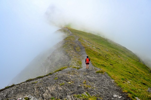
The hike steadily climbs through the forest before starting to level out with frequent views to the turquoise lakes through the trees. Eventually you emerge from the forest and into open plains, before starting a steep ascent along the ridgeline over a series of false peaks until you reach the Augstmatthorn summit. This whole ridgeline offers up postcard views.

The hike starts at an elevation of around 1300 metres and takes you up to just over 2100 metres – so you’ll need to be reasonably fit to take on this hike.
Take some lunch up on your hike and enjoy the views before returning the way you came.
You can make the choice to return on the funicular or walk an hour down to the start of the trailhead. If it’s a warm day, you can opt to cool off after the hike with a dip in the river coursing through Interlaken. Be warned, it’s cold – even in the peak of summer.
Brienzee to Geissbach
Duration: 2-3 hours return
Starting point: Isetwald bus stop
For an easy, scenic walk you can take a bus from Interlaken to Isetwald (the trip takes about half an hour) and walk along Brienzsee (Brienz Lake) to Giessbach. The hike takes you along the edge of the lake most of the way, and through a pleasant forest over a rocky trail. Once you reach Giessbach, there’s a couple of waterfalls in the area to check out.
On a warm summer’s day, Brienzsee is also the perfect place to cool off with several swimming areas located on the lake’s shores.

Schynige Platte
Duration: 3-7 hours depending on route
Starting point: Wilderswil train station
If you’re after another hike with breathtaking views near Interlaken, then head up to Schynige Platte. To get there, you can take the train from Wilderswil Station up to Schynige Platte and then start the
hike. Local buses regularly make the trip from the centre of Interlaken to Wilderswil.

Once you reach Schynige Platte, there’s a couple of options. You can simply enjoy a short walk to several viewpoints overlooking Brienzsee (Brienz Lake) and then return the way you came, or you can go all the way to Bachalpsee (Bachalp Lake) and the Grindlewald First station and return to Interlaken via Grindlewald.

The one way trip from Schynige Platte to Grindlewald First will take about 6-7 hours.
Given Switzerland was going through a heatwave at the time I did this hike and the trail is very exposed – I opted to head in the general direction of Bachalpsee then turned around about a third of the way, and then did Bachalpsee on a cooler day going direct from the Grindlewald side. I also opted to stay the night in a dorm room at the Grindlewald First station so I could see a sunrise over the mountains. It’s not cheap but I think it was worth it.


To get to Bachalpsee from Grindlewald, take the gondola up to Grindlewald First station and then follow the signs. The return hike takes about two to three hours and you can also add a side trip up to the mountain hut on Faulhorn.
Kleine Scheidegg
Duration: 2-4 hours return dependent on your descent route
Starting Point: Mannlichen cable car station (via Wengen)
For a good view of the famous Eiger, then head along the Kleine Scheidegg trail. You can get there from Lauterbrunnen by taking the train up to Wengen from the Lauterbrunnen train station, and then the cable car up to Mannlichen. From Mannlichen, it’s a leisurely, flat one to two hour walk over to the Kleine Scheidegg station with views of the Eiger and surrounding mountains, and down to the town of Grindlewald.

From here, it’s possible to walk back down to Wengen or Lauterbrunnen, or if you’re short on time, you can take the train back down to Wengen – or simply return the way you came.

Murren Klettersteig (via ferrata)
Duration: 3-4 hours one way
Starting point: Murren village
If you’re sure-footed, have a head for heights and are looking for a unique trail, then you might want to head up to the Murren via ferrata. You can reach the via ferrata trail via a couple of ways. The most scenic route is by heading up to the Grutschalp station on the cable car from the centre of Lauterbrunnen, and then walk towards Murren. This walk takes about an hour but includes beautiful views of the Eiger, Monch and Jungfrau peaks as well as the Lauterbrunnen Valley.

From Grutschalp, you can also take a train. Alternatively, head over to the Schilthornbahn cable car to reach Murren. You have to change cable cars at Gimmelwald and then get off at the Murren station.

Once in Murren, you can hire via ferrata gear (helmet and harness) from the Murren Intersport for €25. Gloves are also available.

The via ferrata starts from just around the corner from the Intersport, and you don’t need a guide. However, it’s recommended for people with some via ferrata experience. You do need to be surefooted as you’ll be walking on steel rungs and ladders most of the way, as well as being completely comfortable with heights as there’s some very exposed sections. If you’re scared of heights, this is not the activity for you.
The via ferrata takes about 3-4 hours depending on your pace and how many people are on the trail as there are a number of sections where it is difficult to pass slower people on the trail.

The route features a number of ladders, iron pegs secured to exposed rock walls and several wire bridges, as well as a scenic suspension bridge overlooking a gorge. One section will even make the most confident with heights a little shaky as you traverse a cliff face with nothing below your feet for hundreds of metres.

You will end the hike at Gimmelwald, and then will need to walk back up to Murren or take the cable car up to return the hired gear back to Intersport.
If you have a little energy left, you can also walk to the Sprutz waterfall. The waterfall is located about a 45 minute one way hike from Gimmelwald.

Lauterbrunnen/Trummelbachfalle
Duration: 2 hours return
Starting point: Lauterbrunnen train station
You don’t have to go far for views in Lauterbrunnen. The town itself has postcard views, with a prime position in a valley carved by glaciers and framed by a couple of waterfalls. Everywhere you go in the Lauterbrunnen Valley is a photo opportunity.

You can also head over to Trummelbachfalle, which features 10 glacier fed waterfalls inside a mountain. These are said to be the only glacier fed waterfalls inside a mountain that are currently accessible in Europe – so it’s definitely impressive and worth a look.
Trummelbachfalle is within walking distance from the centre of Lauterbrunnen along a flat trail. It will take you about 45 minutes one way. Entry is €14 (July 2022).
Zermatt
There’s a range of hikes you can do from Zermatt depending on how hard you would like to go.
For an easy scenic stroll, you can head over to the Gorner Gorge, which features a series of boardwalks taking you through a short section of the gorge. Entry is €5, cash only on entry.

For a harder hike, head up to Schwarzsee. On a clear day, you will get views of the Matterhorn from this viewpoint. You can hike up here in 3-4 hours from the town centre or take the gondola up to Schwarzsee station and then walk down.

It’s easy to choose your own adventure in Zermatt with a range of well-signed trails leading from Zermatt and an efficient network of gondolas to get you up or down.
